7 Years
I had my Leatherman tool, on my belt, for seven years. My soon-to-be-PhD-advisor-at-the-time, Dr. Steven Siciliano, gave me a Leatherman Charge TTi - a top-of-the-line multitool - before my first field season with him and his research group in 2009. He gave it to me around March or April of that year, and I've worn it on my belt nearly every day since then.
That's around 2500 days of that lump of complex, hinged, bladed metal on my left hip. I've gone through three sheaths and I don't know how many subconscious hand-passes over my belt to make sure its still there.
Early this year I accidentally tried to take it through security at Pearson International Airport, on my way to visit Charlie in February. The security personnel were quite nice and polite about it, and let me mail it back to myself in Waterloo; it was waiting in my mailbox when I returned a week later.
At the end of my 6-week-long bookended-by-conferences early-summer-2016 fieldwork I sent it in to Leatherman's facilities in Burlington, Ontario, for warranty repairs. Before I flew from Calgary to Fredericton, I went to Canada Post and sent it to Ontario. Tonight, it has been returned to me.
Or rather, an updated substitute has been returned to me, and my Leatherman is no more. Because the Charge TTi has been replaced in the Leatherman Inc. lineup by the Charge Titanium, that is what I now have. This new Charge Titanium is a thing of beauty, a tool of vast utility that fits perfectly with the accessories (sheath, screwdriver bits) I was instructed not to send in. But it's not my Leatherman (yet).
The knife blade is flawless, not the chipped, scratched, and haphazardously-sharpened blade I used to cut ludicrously-fresh tomatoes and pears on the top of an Arctic mountain.
The saw blade is perfect, not the scratched, difficult-to-open tooth I used to cut branches and an uncountable number of zipties (using the sharp hook on its tip) on seven years of Arctic expeditions and Prairie Rivers canoe trips.
The file - both sides! - is clean to the point of optical illusion along its cross-hatched surface, and bears no trace of the steel soil-gas probes I filed and filed and polished and cursed before fitting their machinist-perfect but field-work-distorted hammer-cap on to drive into the rocky soil of the Arctic polar deserts.
The pliers are smooth and shiny, not the sticking, misaligned grip I pulled endless nails from endless boards with.
Even the scissors, tiny and sharp, are quite excellent, and not the cutters I pushed and squeezed through paper, string, cardboard, and plastic over the majority of a decade.
I'm going to enjoy and appreciate this tool over the next seven years - or more! - but I do feel like an old friend has been lost, and a concrete symbol of my PhD has disappeared.
Thank you, Leatherman, for making such fine tools. I hope my use of this new multitool lives up to the legacy of the previous one. And thank you, Dr. Siciliano, for sending me down this pathway seven years ago.
Showing posts with label Summer 2008. Show all posts
Showing posts with label Summer 2008. Show all posts
Friday, June 10, 2016
Monday, November 23, 2009
Dr. Rob E. Roughley
I received an email today, informing me that a man I was proud to call a colleague and fellow traveller in this business of science has died. Professor R. E. Roughley was not someone I knew well, but I did benefit from knowing him as much as I did, and I am saddened by his death.
Rob was an expert on water beetles, particularly of the family Dytscidae, which is a group I worked on for the time I was based in Guelph. Rob provided excellent advice on methods of capturing, identifying, and generally working on these beetles and other small animals commonly found in the numerous small lakes, ponds, streams, and rivers of North America. His advice was always useful, and I can think of many instances where his help turned my fieldwork, collecting aquatic animals, from hopeless to bountiful.
We shared a glass or two of whiskey while we were both in Churchill in the summer of 2007. I raise my glass now to his fond memory. Goodbye Professor Roughley, you will be missed.
Rob was an expert on water beetles, particularly of the family Dytscidae, which is a group I worked on for the time I was based in Guelph. Rob provided excellent advice on methods of capturing, identifying, and generally working on these beetles and other small animals commonly found in the numerous small lakes, ponds, streams, and rivers of North America. His advice was always useful, and I can think of many instances where his help turned my fieldwork, collecting aquatic animals, from hopeless to bountiful.
We shared a glass or two of whiskey while we were both in Churchill in the summer of 2007. I raise my glass now to his fond memory. Goodbye Professor Roughley, you will be missed.
Wednesday, February 18, 2009
Book Club: Quest of the Seventh Carrier

Quest of the Seventh Carrier
Peter Albano, 1989
Zebra Books / Kensington Publishing
New York, New York, USA
This book is terrible, but as soon as I saw the description on the back cover, I knew I had to read it despite the promise of utter ridiculousness. I’ll just quote that back cover verbatim, then describe a few of the many things in this book that caused the heavy-lift crane I was using to suspend my disbelief to topple into the literary pit of doom (metaphorically speaking, of course).
Peter Albano, 1989
Zebra Books / Kensington Publishing
New York, New York, USA
This book is terrible, but as soon as I saw the description on the back cover, I knew I had to read it despite the promise of utter ridiculousness. I’ll just quote that back cover verbatim, then describe a few of the many things in this book that caused the heavy-lift crane I was using to suspend my disbelief to topple into the literary pit of doom (metaphorically speaking, of course).
OUT OF THE ICE…
On the eve of the 1941 surprise attack on Pearl Harbor, the awesome 84,000-ton Japanese supercarrier Yonaga was trapped by an unexpected glacial shift and frozen in an Arctic iceberg. Now, more than forty years later, a deadly Chinese orbiting particle-beam laser that has rendered the Earth’s high-tech weaponry useless has also freed the forgotten warship from its icy prison. The Yonaga sails again, suddenly the most lethal fighting machine in the world’s dwindling arsenal of destruction!
..INTO THE FIRE
Power bases have shifted dramatically over the past four decades – and now a Libyan madman has the upper hand, planning to mercilessly crush his Western enemies with an overwhelming army of ten million Arab fanatics. Only Yonaga and her indomitable samurai crew can save the besieged free world from the devastating iron fist of a terrorist maniac – as the floating behemoth leads a rag-tag armada of rusty World War Two warships against impossible odds on a fiery sea of blood and death!
Leaving aside the increasingly-ludicrous description on the back of the book, this book is basically bad. I don’t want to spend too much time dwelling on how stupid this book is, so I’ll not talk too much about the sloppy editing, sloppy page-setting, wooden dialogue, boring action sequences, cardboard-cut-out clichéd characters, or many other problems. Rather, I’d like to talk about the weirdest feature of this very weird (in a bad way) book: it reads like the middle book of a trilogy, but no mention is made anywhere of other books in this series.
The whole part of the story concerning the freezing of the ship, its long imprisonment, or its 42-years-late attack on Pearl Harbor, plus the launch and critical malfunction of the Chinese satellites and the resulting shift in global geopolitics, all happens before this book starts. There are frequent references in the text to major events (battles, love affairs) the main characters were involved in prior to the start of this book, but no details are provided. The end of the book is not a cliff-hanger, but it certainly does not feel like the end of the story, strongly suggesting a sequel. Despite the obvious hints at a series rather than a single, 381-page story, the usual if-you-liked-this-you’ll-also-like-these lists of other books at the front and back of this book contain no other books by Mr. Albano, nor any books that, from the blurbs, seem thematically related.
Finally, I’d like to return to the back cover description. It’s all lies. The Yonaga is described as 82,000 tons inside, not 84,000. It was never frozen in an Arctic iceberg, rather it was imprisoned “behind a suddenly sliding glacier” somewhere on the Siberian North-East coast (where nobody saw it for 42 years, despite significant Soviet and American military activity in that area). The Chinese satellites are plural, and are described as shooting down all rockets and jet engines, including small hand-held rockets such as RPGs. It does nothing to other technologies, like radar or computers, yet for some reason every aircraft in this book is WWII vintage, and no modern turboprops are used, ever, despite this book taking place about 2 years after the launch of the satellites. The laser satellites were launched several weeks after the Yonaga sailed South and attacked Pearl Harbor, and had nothing to do with the Yonaga being freed from the ice. The rise in geopolitical power of Moammar Khadafy is described as being triggered by a simultaneous loss of air superiority by a jet- and rocket-dependent NATO and a world-wide oil embargo by OPEC. No mention is made of, say, the massive arsenals of non-flying conventional weapons owned by NATO and the Warsaw Pact, nor of the significant advances in electronic technologies since 1941. The “samurai crew” are just plain stupid, a collection of 60-year-old men who act 20 and take orders from a 100-year-old admiral who acts 30. And there’s no “impossible odds”, and no “rag-tag armada” in sight.
Overall, I highly recommend not reading this book. If you want a silly page turner, I would recommend something border-line plausible from Dean Koontz or one of his imitators. If you want to distract yourself from all that is good and entertaining about the written word, then by all means pick up this book. Don’t read it, but maybe if you pick it up and put it down a few hundred times you’ll work some key muscles.
The whole part of the story concerning the freezing of the ship, its long imprisonment, or its 42-years-late attack on Pearl Harbor, plus the launch and critical malfunction of the Chinese satellites and the resulting shift in global geopolitics, all happens before this book starts. There are frequent references in the text to major events (battles, love affairs) the main characters were involved in prior to the start of this book, but no details are provided. The end of the book is not a cliff-hanger, but it certainly does not feel like the end of the story, strongly suggesting a sequel. Despite the obvious hints at a series rather than a single, 381-page story, the usual if-you-liked-this-you’ll-also-like-these lists of other books at the front and back of this book contain no other books by Mr. Albano, nor any books that, from the blurbs, seem thematically related.
Finally, I’d like to return to the back cover description. It’s all lies. The Yonaga is described as 82,000 tons inside, not 84,000. It was never frozen in an Arctic iceberg, rather it was imprisoned “behind a suddenly sliding glacier” somewhere on the Siberian North-East coast (where nobody saw it for 42 years, despite significant Soviet and American military activity in that area). The Chinese satellites are plural, and are described as shooting down all rockets and jet engines, including small hand-held rockets such as RPGs. It does nothing to other technologies, like radar or computers, yet for some reason every aircraft in this book is WWII vintage, and no modern turboprops are used, ever, despite this book taking place about 2 years after the launch of the satellites. The laser satellites were launched several weeks after the Yonaga sailed South and attacked Pearl Harbor, and had nothing to do with the Yonaga being freed from the ice. The rise in geopolitical power of Moammar Khadafy is described as being triggered by a simultaneous loss of air superiority by a jet- and rocket-dependent NATO and a world-wide oil embargo by OPEC. No mention is made of, say, the massive arsenals of non-flying conventional weapons owned by NATO and the Warsaw Pact, nor of the significant advances in electronic technologies since 1941. The “samurai crew” are just plain stupid, a collection of 60-year-old men who act 20 and take orders from a 100-year-old admiral who acts 30. And there’s no “impossible odds”, and no “rag-tag armada” in sight.
Overall, I highly recommend not reading this book. If you want a silly page turner, I would recommend something border-line plausible from Dean Koontz or one of his imitators. If you want to distract yourself from all that is good and entertaining about the written word, then by all means pick up this book. Don’t read it, but maybe if you pick it up and put it down a few hundred times you’ll work some key muscles.
Tuesday, January 27, 2009
Summer Summary
I have neglected this blog for far too long, and if you now find yourself agreeing with this statement, perhaps muttering something like “damn right! update already!”, then you should know that you are by no means alone in expressing this sentiment.
Summer Plan
Part I June 9 - June 25
Part I, Day 1 Ohio storms
Part I, Day 2 Across the Ohio River
Part I, Day 3 An inauspicious start to sampling
Part I, Day 4 First amphipods
Part I, Day 5 Snake!
Part I, Day 6 Into Florida
Part I, Day 7 Lost forceps
Part I, Day 8 Southern Limit
Part I, Day 9 Lake Pasadena
Part I, Day 10 Giant insects
Part I, Day 11 Chatahoochee
Part I, Day 12 Ruralicious
Part I, Day 13 Alabama Sucks
Part I, Day 14 Victory at last
Part I, Day 15 Corbin the Cockroach
Part I, Day 16 Virginia
Part I, Day 17 Home again, briefly
Interlude I
Part II June 27 - July 6
Part II, Day 1 To Superior
Part II, Day 2 RV
Part II, Day 3 Halfway Lake
Part II, Day 4 Superior splash pools
Part II, Day 5 Canada Day
Part II, Day 6 Hattie Cove
Part II, Day 7 Ignace
Part II, Day 8 Winnipeg
Part II, Day 9 Highway 6 North
Part II, Day 10 Thompson
Interlude II
Part III July 8 - July 19
Part III, Day 1 Churchill
Part III, Day 2 Launch the Zodiac
Part III, Day 3 Early tide
Part III, Day 4 Rescued
Part III, Day 5 Twin Lakes
Part III, Day 6 Bravos and Bugs
Part III, Day 7 Reinventing the Wheel
Part III, Day 8 Sea North
Part III, Day 9 Tundra ponds
Part III, Day 10 Churchill's diverse habitats
Part III, Day 11 Boat extraction
Part III, Day 12 Parks day
Book Club: Coast Guard to the Rescue
Interlude III
Part IV July 21 - August 4
Part IV, Day 1 Inuksuk
Part IV, Day 2 Iqaluit
Part IV, Day 3 Fly North
Part IV, Day 4 ATV
Part IV, Day 5 Amituk
Part IV, Day 6 Devon Island
Part IV, Day 7 Truelove
Part IV, Day 8 Asim's transect
Part IV, Day 9 Truelove's diverse habitats
Part IV, Day 10 Dayhike
Part IV, Day 11 Work on the transect
Part IV, Day 12 Air traffic control
Part IV, Day 13 Resolute wetlands
Part IV, Day 14 Maretta Lake
Part IV, Day 15 Arctic Ocean intertidal
Interlude IV
Book Club: Quest of the Seventh Carrier
Summer Summary
Anyway, one of the blocks in my mind that has been holding me back from writing here has been my desire to summarize my amazing summer of fieldwork in a single post. This is not an easy task. Looking back through what I did and what I wrote here, I find it difficult to summarize my summer in a reasonable fashion.
When I tell people what I did this past summer, I usually describe my activities as a giant transect of the Eastern half of North America. This isn’t really accurate, since I only sampled a fraction of the aquatic ecosystems East of the 100th meridian. I do think I visited a pretty good representative sample of those ecosystems, but to describe my activities as a “transect”, a term with a clear definition in ecological statistics, is probably not really correct.
I opened this series on my summer, this “travelblogue”, with a brief description of my plans. Rather than recap that here, or try to quantify my success in achieving the goals I had laid out for myself, I’d like to talk about the impact this summer had on my life and how I think about my career and this business of science more generally. I’m still going to have to recap my summer, but I think I can do this in a way that isn’t just a link-fest or massively redundant.
I’m glad I started by dividing the summer into 4 parts – this turned out to be a logical and useful way of categorizing my activities. Each part was distinct from the others in several ways – I travelled with different people, and I scheduled my days in different ways, quite apart from the obvious differences among the research sites I sampled. I was one member of a partnership of two in Part I. Matt and I worked together on nearly every aspect of our trip through the Eastern U.S.A. We had an overall schedule, based mainly on my need to return to Guelph in time to depart with other people on Part II. But while I had planned approximately where we would stay each night in the U.S., we deviated from that plan almost immediately. Instead of spending 3 nights in Georgia, we spent 4. We lingered longer in North-Central Florida than I had anticipated, by about a day. Local conditions, especially drought, restricted the number of sampling sites we visited at the extreme southern end of our journey. And of course, Alabama sucks, a fact that surprised us.
During Part II, rather than travelling in an equal partnership with one other PhD candidate, I accompanied a somewhat mixed group of people. The limits of budget and what can be accomplished by a single person working alone dictate the details of some travels, as I’m sure most people are aware. While ideally I would have liked to sample Northern Ontario and Manitoba in a manner similar to how I’d sampled Georgia, instead I camped at one location for several days, and repeatedly sampled a few locations.
This trend of more time at fewer places was extended upon my arrival at Churchill in Part III. I visited Churchill last year, so I already had a pretty good idea of what to expect in terms of daily schedules and the types of sites I can visit. I didn’t use the Zodiac of Adventure very much at all last year, but I had lots of fun with it this year. The feature of working in Churchill that perhaps stands out most in my mind was the bear gun. I worked with 7 other people while at Churchill, and I was 1 of only 2 people licensed to carry a firearm. The other license-holder refused to share this duty, so I was left holding the gun every day we had access to one. While I admit that I felt pretty bad-ass for the first 20 minutes on the first day I carried a CNSC shotgun, the novelty wore off quickly. I was glad to have the gun when we did encounter a polar bear, but most of the time it was heavy, awkward, and socially disruptive. There’s no surer way to end a conversation than to work the action on a 12-gauge pump a few times. That sound is unique, and instantly recognizable to any person who has seen an action movie. It carries a certain malice or threat with it, and gathers to itself and its weilder every person’s attention. It’s a good thing my fear of public speaking was burned out of me by my armour-piercing voice many years ago.

My firearms license, technically referred to as a Posession and Acquisition License, or PAL. It really wasn’t that difficult to get, a fact that may be surprising to those people who believe Canada operates very restrictive gun control.
Guns and the polar bear concern were still around in Part IV, but to a much reduced degree. Fieldwork alone was still impossible in the Far North, but this has less to do with the predators and more to do with everything else that can possibly go wrong. “Weather and mechanical permitting” applies everywhere, I think, but the frequency distribution of unfortunate events across space and time has a peak in the High Arctic. I was essentially alone for the final part of my summer, right as I entered the region of North America where working in groups is most important. There is probably some irony in that, somewhere. Meeting new people primarily for the purpose of working with someone was a major aspect of my social activities in the Far North. By the end of my visit to Resolute, in those last couple of days before flying South, this odd kind of social interaction was not even subconscious: I deliberately introduced myself to people as an individual in need of a field assistant. It’s kind of an odd way to meet somebody for the first time; one basically talks in euphemisms for “can I trust you with my life for a few hours?”.
Perhaps this review sounds a little negative. It should not, for I had a truly wonderful time all summer. I basically dislike waking up in the morning, those who know me know I am no morning person. But while a 7:00am alarm while at home is cause for despair, during my travels such things did not bother me. Every day was an adventure, which is to say every day had its share of sub-lethal misfortune. Whatever doesn’t kill me makes me stronger, and all that.
So, how did this amazing summer shape my view of myself, my career, and the process of scientific investigation?
First, some introspection. I did accomplish some things in ways that impressed myself, so I suppose my general self-esteem and self-confidence were improved by this summer. But that seems a minor effect. Rather than demonstrating what I can do, I think of this summer as showing me more of what I would most like to do. I wasn’t surprised by my conduct during the bear encounter, possibly the single most significant event this summer from a perspective of personal introspection. I was quite happy with how that all turned out; the interesting part is that I’d be quite happy to go out and do such things again. Meeting a bear on a desolate Northern beach was not an encounter that turned me off of fieldwork; quite the opposite, in fact, I’d like the to spend more time in such environments, as I now have a great deal of confidence (and solid empirical evidence) that I can work effectively under such conditions.
Career-wise, there were two great and related realizations for me that came out of this summer. First, the component of my PhD project that I think I most enjoy is the Biogeography side of things. I had inklings in this direction while I was studying for my PhD exams; the textbook “Biogeography” that I read was actually enjoyable in places, but getting outside and really seeing the world from a biogeographic perspective was the real eye-opener. Second, the Arctic really appeals to me. I had a great time in Florida, but I really felt most enthusiastic about my research when I was in Churchill, Resolute, and Truelove. I would frequently stop and just look around, thinking about how great it was that I had this opportunity to visit such spectacular places. These two realizations together of course suggest that I will be happiest in my work if my work involves the patterns and processes of distributions of species at high latitudes. That shouldn’t be too difficult to work into a grant proposal.
My view of scientific investigation, the process of doing science, was not shaken or drastically challenged by this summer. Rather, I was exposed in considerable detail to aspects of science that I had previously had only a murky view of. This includes fieldwork in general, of course, since prior to this summer I had only last year’s visit to Churchill and some day-trips around Guelph as my experiences. My undergraduate degree included little in the way of fieldwork as it is actually practiced, and my M.Sc. work was entirely in the laboratory. I like fieldwork. I even like the crappy stuff that goes with it – I would have emptied the shit bucket at Truelove, but Steve beat me to it (he’s more of a morning person than I). Not that I enjoy outhouse maintenance, but it bothers me much less than it does some other people.
I met a large number of other people, many of whom were also engaged in the outdoors side of science. Their projects also looked like great fun, and it was pretty gratifying to have people engaged in fascinating research on climatology, robotics, space science, geology, paleontology, etc. etc. tell me that my project sounded really intersting. I already suspected that Biology and Geology were the academic fields that perhaps attract the greatest numbers of people who want to go camping first, and do science (a close) second, but I got to see and talk with many of these people this summer. Please do not take this as a criticism, or as some ranking of scientific vigour among my colleagues. The people I met (like all people) cannot easily be reduced to a ranked list of interests.
Sorry again about the long delay in my posts here. More interesting stuff than the above wandering musings to come, I promise.
Update: Link ListSummer Plan
Part I June 9 - June 25
Part I, Day 1 Ohio storms
Part I, Day 2 Across the Ohio River
Part I, Day 3 An inauspicious start to sampling
Part I, Day 4 First amphipods
Part I, Day 5 Snake!
Part I, Day 6 Into Florida
Part I, Day 7 Lost forceps
Part I, Day 8 Southern Limit
Part I, Day 9 Lake Pasadena
Part I, Day 10 Giant insects
Part I, Day 11 Chatahoochee
Part I, Day 12 Ruralicious
Part I, Day 13 Alabama Sucks
Part I, Day 14 Victory at last
Part I, Day 15 Corbin the Cockroach
Part I, Day 16 Virginia
Part I, Day 17 Home again, briefly
Interlude I
Part II June 27 - July 6
Part II, Day 1 To Superior
Part II, Day 2 RV
Part II, Day 3 Halfway Lake
Part II, Day 4 Superior splash pools
Part II, Day 5 Canada Day
Part II, Day 6 Hattie Cove
Part II, Day 7 Ignace
Part II, Day 8 Winnipeg
Part II, Day 9 Highway 6 North
Part II, Day 10 Thompson
Interlude II
Part III July 8 - July 19
Part III, Day 1 Churchill
Part III, Day 2 Launch the Zodiac
Part III, Day 3 Early tide
Part III, Day 4 Rescued
Part III, Day 5 Twin Lakes
Part III, Day 6 Bravos and Bugs
Part III, Day 7 Reinventing the Wheel
Part III, Day 8 Sea North
Part III, Day 9 Tundra ponds
Part III, Day 10 Churchill's diverse habitats
Part III, Day 11 Boat extraction
Part III, Day 12 Parks day
Book Club: Coast Guard to the Rescue
Interlude III
Part IV July 21 - August 4
Part IV, Day 1 Inuksuk
Part IV, Day 2 Iqaluit
Part IV, Day 3 Fly North
Part IV, Day 4 ATV
Part IV, Day 5 Amituk
Part IV, Day 6 Devon Island
Part IV, Day 7 Truelove
Part IV, Day 8 Asim's transect
Part IV, Day 9 Truelove's diverse habitats
Part IV, Day 10 Dayhike
Part IV, Day 11 Work on the transect
Part IV, Day 12 Air traffic control
Part IV, Day 13 Resolute wetlands
Part IV, Day 14 Maretta Lake
Part IV, Day 15 Arctic Ocean intertidal
Interlude IV
Book Club: Quest of the Seventh Carrier
Summer Summary
Sunday, November 30, 2008
Interlude IV: 080805
Today is another all-travel day, my last at high latitudes and the second-last day of my whole summer of fieldwork. Now is probably a good time to discuss my impressions and the outstanding events in my mind of the last 2 weeks or so.
In addition to the impressions, I’d also like to describe this day. As I have complained about before, my flight took off from YRB at 6:30am. I was able to grab a very quick shower and about half a cup of coffee, then I loaded my abundant luggage onto a van, with some assistance from the friendly pool-playing German from yesterday. We hung out in the airport with all of our abundant luggages (I’m not the only one – a Palaeontologist was travelling with long metal cases that must have collectively weighed 100 kilograms) for a bit, then boarded the plane, another ATR similar to that which took me here in the first place.
In addition to the impressions, I’d also like to describe this day. As I have complained about before, my flight took off from YRB at 6:30am. I was able to grab a very quick shower and about half a cup of coffee, then I loaded my abundant luggage onto a van, with some assistance from the friendly pool-playing German from yesterday. We hung out in the airport with all of our abundant luggages (I’m not the only one – a Palaeontologist was travelling with long metal cases that must have collectively weighed 100 kilograms) for a bit, then boarded the plane, another ATR similar to that which took me here in the first place.
 My last view of Resolute. The bright blue-and-red building on the left is the warehouse / control tower / laboratories.
 An aerial view of Char Lake.
 Southern Cornwallis Island.
 Scattered sea-ice in Foxe Basin, Southwest of the main part of Baffin Island.
We landed and changed planes in Iqaluit, but I was only on the ground there for about 2 hours. I collected my abundant luggage, then hung out in the departure lounge (after actually going through security) until my plane boarded. There was a bit of confusion, with 2 flights on two different airlines leaving at almost the same time, but I managed to get on board without any trouble. It helps that I don’t mind being the last to board an aircraft, and that I’m in “airport mode”, which strips all anxiety from my emotions as I patiently wait to get on and off large vehicles. Northern Quebec, just inland from Ungava Bay.
I landed in Ottawa on time, at around 5:00 in the afternoon, to be greeted by a childhood friend and her baby daughter. They were easy to pick out of the crowd around the luggage conveyor – not many people were greeted by hyperacheiving supermodel-esque young women carrying infants. My abundant luggage gathered, I got culture-shocked loading the Subaru and being driven through suburban Ottawa. Trees! Grass! People! Warm temperatures!
Tomorrow I’ll take a reasonably-timed (noon-ish) train from Ottawa to Guelph, via Toronto. With my abundant luggage.
The Daily Grind
My days in the High Arctic were often quite different from each other, and I never really settled into a routine, with the exception of a few days in a row on Devon Island. However, almost all my days placed a strong importance on mealtimes, and I drank much less coffee than I normally would, in clear opposition to Part I of this trip. For whatever reason, daily events were built around the framework of mealtimes.
Vehicle
There was no single all-important vehicle in Part IV, but I did have several firsts: my first time driving an ATV, and my first ride in a helicopter and a Twin Otter. Airport security in the High Arctic is opposite that of the rest of the world: there’s no fence or barrier completely enclosing the airport, and rather than ensuring one’s weapons are secured in checked luggage, the pilot won’t let you on board without a gun. The saying in the North is “weather and mechanical permitting”, because both factors are highly important in determining when and if one will fly. Packing is obviously important, and I’ve already talked too much about my abundant luggage. Still, I managed to get around when and where I needed to go, without too many hassles.
Lodgings
Hotels in the Far North are expensive. My two nights in Iqaluit ran to nearly $500, including food (one meal was free) and taxi rides across town. My stay at the PCSP was covered, not by my supervisor’s grant but by the agreement for logistical support between our lab and Natural Resources Canada. At least, we think so – the detailed financial side of that agreement remains something of a mystery to myself, my advisor, and even the financial services people at the University of Guelph, who said they’d “never seen anything like this” when I showed them the weird credit application back in May.
The PCSP facilities were great. Two beds per room, no bunk beds, and no mosquitoes. The food was excellent, the people were friendly, and the pool table was free. I also enjoyed the library – there’s a shelf running along two walls in the common room covered in books left by travellers. About 1/3 of them are in French, and the selection in English is eclectic and interesting. I ended up reading Skipping Towards Gomorrah by Dan Savage from that collection, and it was excellent.
An anecdote: after my return from Devon Island, I had 2 nights inside the actual building of the PCSP, after my 2 nights in the Weatherhaven. The first of these, I had no roommate – I had room 116 entirely to myself (the same room as I had when I first arrived, a week previously). Drunk on the unfamiliar luxury of privacy, I locked the door. Then I managed to lock myself out of my own room after midnight, and I had to wake up a few staff members to get back in. Knocking on an unknown staffer’s door at 12:30am wearing only my boxer shorts is not an experience I wish to repeat. Still, the people I woke were all discreet and polite the next day, and nothing was said of my nocturnal misadventures.
On Devon Island I slept in a tent, a bright yellow Eureka model with poles now permanently deformed from the strength of the wind. My sleeping pad had the name “BLISS” written in permanent marker on the top corner – it is not unlikely that the great L.C. Bliss used this pad during his stays here more than 30 years ago. A little on the thin side, but quite comfortable.
Other People
With the exception of the staff and pilots of the PCSP, everyone I met in Resolute was a scientist of some variety – geologists and geomorphologists, ecologists and ecotoxicologists, meteorologists and anthropologists, and one robotocist from the University of Toronto. He was up there working at The Crater on Devon Island, developing autonomous robots for use on Mars. I asked him a question he’s been asked many times before: what’s the minimum definition of a robot? The answer is simple and has surprising implications: a sensor and an actuator connected in some logical fashion. For example, a camera (sensor) that feeds information to a processor that makes decisions about where to move its wheels (actuators) next. As pointed out by the robotocist, this definition includes a toilet in the category “robots”. The sensor determines the water level inside the toilet tank, and is connected to a valve that refills the tank when the water level falls.
In Iqaluit, I met a few other scientists, along with lots of other people. In Rankin Inlet, I met only a few people, all of whom were employees of the various facilities I visited – the airport, the post office, a diner – and all of whom seemed entirely unsurprised by my presence, while I was highly surprised by my entire visit to Rankin.
The most important people I met on this trip were my direct collaborators, in the form of Dr. Derek Muir of Environment Canada and Dr. Steve Siciliano of the University of Saskatchewan. Dr. Muir I had met before; I visited him at his office in Burlington when I was planning my summer. Dr. Siciliano I had never met before, but despite knowing me for approximately 3 seconds, he invited me to Devon Island, all expenses paid.
Geography
The Far North is entirely beyond the tree line, at least everyone I went. Perhaps in the far West of the Arctic there are trees, but not where I was. This lack of trees is striking, for it is absolute. Unlike the generally treeless terrain of Churchill or the prairies, where there is usually one tree every so often, often as an ornamental on somebody’s lawn, there are no trees AT ALL in the High Arctic. For that matter, there are no lawns, and very little grass, too.
I’ve already mentioned the false-horizon effects of a treeless landscape and the gently rolling hills of eroded dolomite. The places I visited were not flat, but nor were they particularly rugged. Rankin Inlet sits on the flat coastal plain around Hudson Bay, but Iqaluit, Resolute, and the Truelove Lowlands are all surrounded by hills, with ponds, lakes, and streams throughout.
Collecting Sites and Maps
As during previous parts of this summer, my collecting sites were chosen haphazardously; I took what I could get. There are limitless numbers of small ponds and lakes sitting on the permafrost, and the only time I was not able to find some wet places to sample was in the highlands surrounding Amituk Lake. But even there I was able to find a trickle of water harbouring life.
I had topographic maps and a marine chart of the area around Resolute Bay, but I foolishly forgot these maps at home in Guelph when I embarked on June 27. There were good charts posted on the walls at the PCSP, and they had a sometimes-working internet connection that I could use for the same purpose. On Devon Island, there were maps posted in the kitchen at camp of the Truelove Lowlands, but in any case on Devon I was restricted to how far I could walk, and I was never more than about 10 kilometres from camp.
Animals
I saw one polar bear (Ursus maritimus) in the High Arctic, from the helicopter on my flight back to Resolute from Devon Island. I also saw a single beluga (Delphinapterus leucas) from that helicopter, in the sea between Cornwallis and Devon Islands. We saw musk-oxen (Ovibos moschatus) at Truelove, along with a Peary Caribou (Rangifer tarandus pearyi), an arctic hare (Lepus arcticus), ivory gulls (Pagophila eburnea), and a couple of other birds. There where bones from musk-oxen, caribou, and bowhead whales (Balaena mysticetus) under the sign for the Truelove research station.
I found tadpole shrimp (Order Notostraca) and fairy shrimp (Order Anostraca) in the ponds and lakes of Devon Island, along with chironomid midges, enchytraeid worms, and a few other things I’m less certain about.
Miscellany
The logistics of my time in the High Arctic were a little bi-polar. On the one hand, this part of my summer required as much planning and preparation as everything else combined, and schedules were very tight for things like arranging resupply and airline flights. On the other hand, once I was in Resolute, all scheduling and planning shrank to a horizon hours away – I generally didn’t know what I’d be doing the next day each morning. The most striking example of this bipolarity was my trip to Devon Island – I had no idea that a visit to Devon was even a possibility until the morning of the day I went there, and my entire time on Devon was marked by the hard deadline of my scheduled-months-ago flight from Resolute to Ottawa.
Summary
I had a fantastic time during this final portion of my summer of field work. I learned a great deal about a great deal: how to do fieldwork, both in general and specifically in this harsh environment, who are the important figures in my field here, and lots of details about lots of little things like how to drive an ATV, and how to unload a helicopter.
It’s highly unlikely that I’ll visit Resolute again during my PhD, though there is a slim possibility of a follow-up visit to Iqaluit, if those specimens prove particularly interesting, and I can find a bit of funding for that. However, I very much would like to do more research in the High Arctic, and the contacts I made at the PCSP should be highly useful.
Thursday, November 20, 2008
Part IV, Day 15: 080804
My flight Southward is scheduled for a 6:30am take-off tomorrow, so this is my last day of research, and I need to reserve some time to pack and clean up. I convinced a Geography Master’s student from Queen's University in Kingston, Fiona, to learn to drive an ATV and come with me to the beach.
We spent about half and hour driving in circles next to the warehouse, allowing Fiona to learn to drive the ATV. The controls are a little bit counterintuitive to somebody (such as myself, 2 weeks ago) who has never driven a snowmobile or motorcycle. However, an ATV at low speed is so ridiculously stable (a different story at full throttle) that we were able to embark with confidence after a little bit of practice.
First, we drove down Thule road, one of the few roads around here that I think justifies a name. I’m not certain this is the official name, but at the end of the road lies the anthropological dig studying the Thule people. I’m hazy on the details, but apparently the Thule people lived here before the Inuit moved into the area; they had a camp or village or something here, on the shore of Resolute Bay between the PCSP and the modern village.
I put on my chest waders and strode out into the Arctic Ocean. Surprisingly, low tide was at a reasonable hour, around 10:20, so I was able to visit the beach with much of the water gone away. The water was shockingly cold, even through the thick rubber of my waders. I found a variety of amphipods, hiding under the apparently-barren rocky gravel of the submerged shoreline. Among some larger rocks at the end of the beach I found a few different species, I think, including a few larger individuals (about 4 centimetres).
We had sufficient time to also visit the bay in the town of Resolute, accessible by driving through a construction site and an industrial zone. Today is a civic holiday, so nobody was working here, but it looks fairly active. I wonder what the purpose of all this activity might be.
The shoreline of the bay here was clogged with jumbled sea-ice. Sea-ice looks and feels different from freshwater ice that covers lakes and forms icebergs. It’s crunchy and a bit softer, and a bit more greyish in colour. That could be an artefact of the boring grey substrate, though.
 Here’s a picture of me, standing on a grounded chunk of sea-ice with part of the town of Resolute Bay in the background. The wet stains on my jacket and pants are from when I was holding my net and picking out amphipods; that’s salt water and will dry rapidly in this polar desert. Notice my boots: I have now worn them in the Pacific, Atlantic (Gulf of Mexico), Hudson Bay, and Arctic Oceans, plus innumerable bodies of freshwater in North America.
 In the evening, I watched a jet take off from Resolute Bay airport (YRB). The dust-cloud was incredible – 2 kilometres long and ½ a kilometre high, and thick enough to block visibility for a full 5 minutes. This picture is just the start of the take-off run.
Tomorrow is my flight South, starting at 6:30am and ending in Ottawa at about 5:00pm. I spent this evening packing, and talking briefly with my new roommate, a friendly Brit just back from some geology (mining surveys) on Ellesmere Island. I promised to try to avoid waking him as I depart at some horrid hour tomorrow morning.
We spent about half and hour driving in circles next to the warehouse, allowing Fiona to learn to drive the ATV. The controls are a little bit counterintuitive to somebody (such as myself, 2 weeks ago) who has never driven a snowmobile or motorcycle. However, an ATV at low speed is so ridiculously stable (a different story at full throttle) that we were able to embark with confidence after a little bit of practice.
First, we drove down Thule road, one of the few roads around here that I think justifies a name. I’m not certain this is the official name, but at the end of the road lies the anthropological dig studying the Thule people. I’m hazy on the details, but apparently the Thule people lived here before the Inuit moved into the area; they had a camp or village or something here, on the shore of Resolute Bay between the PCSP and the modern village.
I put on my chest waders and strode out into the Arctic Ocean. Surprisingly, low tide was at a reasonable hour, around 10:20, so I was able to visit the beach with much of the water gone away. The water was shockingly cold, even through the thick rubber of my waders. I found a variety of amphipods, hiding under the apparently-barren rocky gravel of the submerged shoreline. Among some larger rocks at the end of the beach I found a few different species, I think, including a few larger individuals (about 4 centimetres).
We had sufficient time to also visit the bay in the town of Resolute, accessible by driving through a construction site and an industrial zone. Today is a civic holiday, so nobody was working here, but it looks fairly active. I wonder what the purpose of all this activity might be.
The shoreline of the bay here was clogged with jumbled sea-ice. Sea-ice looks and feels different from freshwater ice that covers lakes and forms icebergs. It’s crunchy and a bit softer, and a bit more greyish in colour. That could be an artefact of the boring grey substrate, though.
Here’s a picture of me, standing on a grounded chunk of sea-ice with part of the town of Resolute Bay in the background. The wet stains on my jacket and pants are from when I was holding my net and picking out amphipods; that’s salt water and will dry rapidly in this polar desert. Notice my boots: I have now worn them in the Pacific, Atlantic (Gulf of Mexico), Hudson Bay, and Arctic Oceans, plus innumerable bodies of freshwater in North America.In the evening, I watched a jet take off from Resolute Bay airport (YRB). The dust-cloud was incredible – 2 kilometres long and ½ a kilometre high, and thick enough to block visibility for a full 5 minutes. This picture is just the start of the take-off run.Tomorrow is my flight South, starting at 6:30am and ending in Ottawa at about 5:00pm. I spent this evening packing, and talking briefly with my new roommate, a friendly Brit just back from some geology (mining surveys) on Ellesmere Island. I promised to try to avoid waking him as I depart at some horrid hour tomorrow morning.
Part IV, Day 14: 080803
Steve was able to arrange a flight Southward for today, so I didn’t see much of him until he shook my hand and we said our goodbyes, around lunchtime. I spent the morning hanging out in the common area of the PCSP dorms / dining room, playing pool with a German post-doc just back from some geology (fossil pollen) on Melville Island, and generally trying to find someone who can drive and ATV and accompany me this afternoon.
Eventually I was able to convince Ann that driving an ATV is very similar to driving a snowmobile. I’d never driven the latter, and she’d never driven the former, but somehow we both decided these vehicles must be almost interchangeable. Ann is an employee of Parks Canada, and has recently been promoted to a supervisory position involving all 4 High Arctic national parks, so she had spent the last week or so flying around to Ellesmere and Banks Islands, to meet the researchers working in those parks. I gather her new job involves monitoring and regulating scientific research in these parks. Permits, and so forth.
We rattled out to Maretta Lake and its associated inflow stream, about 2 kilometres from the PCSP. Maretta Lake was used for some time as a waste-disposal site, and according to the physical-ecology papers I’ve read, is still rather nutrient enriched. It’s still pretty barren, though the inflow stream had some lovely worms. The Daphnia here are so large I was able to capture them individually with my fine forceps.
We also visited a couple of other nearby ponds, which contained a similar assortment of Chironomid larvae and Enchytraeid worms that I’ve seen before. Still, this is essentially what one expects – it would be surprising to find very different things in ponds only hundreds of metres apart.
 This is the only photo of the PCSP sign I took, and I didn’t take it until today. Proof, I supose, of my visit here.
After dinner I spent some time talking with some other people here waiting for flights, and it seems likely that I’ll be heading out again tomorrow with somebody, at least. I need to sample from the intertidal, to get something marine; also, the marine environment is my only likely source of amphipods around here.
Eventually I was able to convince Ann that driving an ATV is very similar to driving a snowmobile. I’d never driven the latter, and she’d never driven the former, but somehow we both decided these vehicles must be almost interchangeable. Ann is an employee of Parks Canada, and has recently been promoted to a supervisory position involving all 4 High Arctic national parks, so she had spent the last week or so flying around to Ellesmere and Banks Islands, to meet the researchers working in those parks. I gather her new job involves monitoring and regulating scientific research in these parks. Permits, and so forth.
We rattled out to Maretta Lake and its associated inflow stream, about 2 kilometres from the PCSP. Maretta Lake was used for some time as a waste-disposal site, and according to the physical-ecology papers I’ve read, is still rather nutrient enriched. It’s still pretty barren, though the inflow stream had some lovely worms. The Daphnia here are so large I was able to capture them individually with my fine forceps.
We also visited a couple of other nearby ponds, which contained a similar assortment of Chironomid larvae and Enchytraeid worms that I’ve seen before. Still, this is essentially what one expects – it would be surprising to find very different things in ponds only hundreds of metres apart.
This is the only photo of the PCSP sign I took, and I didn’t take it until today. Proof, I supose, of my visit here.After dinner I spent some time talking with some other people here waiting for flights, and it seems likely that I’ll be heading out again tomorrow with somebody, at least. I need to sample from the intertidal, to get something marine; also, the marine environment is my only likely source of amphipods around here.
Thursday, November 13, 2008
Part IV, Day 13: 080802
This morning Steve was able to get himself a bed inside the main PCSP building, while I was not. Still, at this point I have an entire Weatherhaven almost to myself, and the cots are pretty comfortable. Steve gave me his extra-thick Therma-a-rest to make things even nicer, and it’s not so cold here in Resolute as it was the last couple of nights on Devon.
After breakfast, Steve spent his time arranging his trip home, which he needs to get done as quickly as possible. My ticket home is still scheduled for August 5, so I’m in no hurry. Besides, my schedule is a little flexible in that the only pressing need to get back to Guelph for me comes from my deep-frozen specimens; I think they’ll stay super-cold until at least August 10 or 12, though obviously I’d like to get them into something more permanent (like a -80°C freezer) fairly soon. I spent my morning doing laundry. This allowed me to fully appreciate the words of Jorg, my roommate on my first night here in Resolute. Jorg told me about his time on Axel Heiberg island, at a camp for three weeks studying glaciers. Then he said "Such a luxury! To be able to do one's laundry!". I now agree.
After lunch, Steve took me out on some ATVs as promised. His flight is likely to go tomorrow, though there are some scheduling issues surrounding his flight and its likely passenger manifest. We wandered around the landscape mostly on the far (North) side of the runway, visiting some wetlands and a flowing stream that I had not had a chance to visit earlier on my trips with Derek, Günter, and Debbie.
 The shore of a pond in a complex wetland. The ground here is saturated with water and extremely soft; I nearly lost a boot going through this.
 Yours truly, hunting for watery critters at a tundra pond near Resolute. Steve Siciliano took this picture, while laughing at my odd obsession for tiny, wet, cold invertebrates.
Tomorrow Steve will (hopefully) be on a plane headed home, and I’ll still have a couple of days to kill with something productive. I plan to recruit some other airport-waiting-researcher as a field assistant, and get around out here to some more habitats. In particular, I have not yet visited a nutrient-enriched lake between PCSP and the town, nor have I collected from the marine realms here.
After breakfast, Steve spent his time arranging his trip home, which he needs to get done as quickly as possible. My ticket home is still scheduled for August 5, so I’m in no hurry. Besides, my schedule is a little flexible in that the only pressing need to get back to Guelph for me comes from my deep-frozen specimens; I think they’ll stay super-cold until at least August 10 or 12, though obviously I’d like to get them into something more permanent (like a -80°C freezer) fairly soon. I spent my morning doing laundry. This allowed me to fully appreciate the words of Jorg, my roommate on my first night here in Resolute. Jorg told me about his time on Axel Heiberg island, at a camp for three weeks studying glaciers. Then he said "Such a luxury! To be able to do one's laundry!". I now agree.
After lunch, Steve took me out on some ATVs as promised. His flight is likely to go tomorrow, though there are some scheduling issues surrounding his flight and its likely passenger manifest. We wandered around the landscape mostly on the far (North) side of the runway, visiting some wetlands and a flowing stream that I had not had a chance to visit earlier on my trips with Derek, Günter, and Debbie.
The shore of a pond in a complex wetland. The ground here is saturated with water and extremely soft; I nearly lost a boot going through this.Yours truly, hunting for watery critters at a tundra pond near Resolute. Steve Siciliano took this picture, while laughing at my odd obsession for tiny, wet, cold invertebrates.Tomorrow Steve will (hopefully) be on a plane headed home, and I’ll still have a couple of days to kill with something productive. I plan to recruit some other airport-waiting-researcher as a field assistant, and get around out here to some more habitats. In particular, I have not yet visited a nutrient-enriched lake between PCSP and the town, nor have I collected from the marine realms here.
Sunday, November 09, 2008
Part IV, Day 12: 080801
Today I did fly back to Resolute, but this was by no means clearly going to happen when I woke up this morning. At morning skid, we were informed that they were trying to figure out how to get the Belcher Glacier team moved as needed, and that we should monitor the radio for further instructions. Since I had approximately nothing better to do, I sat by the radio and wrote down everything I heard after all research teams had completed check-in. The Belcher lower camp reported a bear encounter late last night, which destroyed their tents and some other gear. Thus, they were a high-priority for airlift, though there were some suspicious irregularities with their call. As was asked over the radio by the PCSP, why didn’t they use their sat-phone and call in the bear encounter immediately when it happened? Did they not realize that ALL bear encounters are must-call items?
During my radio-watch, I recorded a few calls that were very unclear to me, but I got the gist that an aircraft, possibly a helicopter, was reporting its position and estimated time of arrival, somewhere, possibly on Devon Island. The pilot was speaking very quickly, in thick flight-jargon, such that I was mostly just guessing regarding times and places. I think all the times were reported based on Greenwich Meridian Time, and here on Devon we’re 5 hours behind.
Eventually, the only calls I heard were clearly coming from the helicopter, and then it arrived. Steve and I walked over to the helicopter while the pilot was refuelling from one of the barrels near the end of the runway. While we had been told nothing, Jim the pilot was able to fill us in on the details of today’s flight plans. He was going to be spending much of the day ferrying gear and people from the Belcher lower camp to Truelove, where they would be picked up by a Twin Otter some time in the afternoon. Belcher lower (and upper, from what I’ve gathered) has no runway suitable for a Twin Otter, but is rather far from Resolute, so Truelove is being used today as a staging and refuelling area for their operations.
Jim told us he had been told there were 9 full fuel barrels here at Truelove, and that he would likely need to use them all. We had no idea, so we stood around and did a quick count, coming up with 6 for sure, and 3 more that might or might not have fuel in them. Despite walking past them every day, no one in camp had ever actually tried to determine how full any of the newer-looking barrels were. Jim said he’d fly over to the pair together that were of unknown contents, and have a look. Steve and I were quite amazed – how can one see how full a barrel is from a helicopter? Jim just grinned and said he’d go have a look.
He took off and moved the 200 metres or so to the pair of barrels, and proceed to hover directly above them for a few seconds. I realized what he’d meant, earlier – a full fuel barrel will not respond to a hovering helicopter, but an empty one will be blown sideways and will roll into the nearest pond. These two barrels stayed rock-solid: they’re full.

 Jim hovered over the fuel barrels for a couple of seconds, then took off rapidly to the East, climbing over the Dolomite Dome towards the Belcher lower camp. At this point I’d like to reiterate that Jim is an excellent pilot; he moved his helicopter in such a way that it was clear he knew exactly what he was doing, and could do it in the most efficient way.
With my radio-tending duties over, and nobody else in need of my help, I kicked around camp for a bit and packed up my bags. At this point, there are two possibilities: either I fly back to Resolute and sleep there tonight, or I stay here at least one more day. Under the first scenario, I’ll need to be packed up and ready to go at a moment’s notice. Under the second, I can always unpack what I need for another night. My borrowed sleeping bag was particularly difficult to get stuffed.
Periodically the helicopter returned, and I helped unload the belongings of total strangers. This was a particularly odd experience because these unknown people sent out their gear in almost the exact opposite order to what I would have done. Considering the ever-present possibility of bad weather or mechanical troubles cancelling flights, I would carry the first-aid kit and about 2 days worth of food as my carry-on luggage, on my lap. The medical supplies, food, camping gear, and kitchen stuff were on the first flight out; the people didn’t come until the fourth flight.
 While I was wandering around, the weather continued to do interesting things. The blocky object in the foreground is a large boulder near camp.
After lunch I headed out with Eric to help him with some of his soil-roots-vegetation research. Marcus and Angela will be digging a few more big holes today and tomorrow, and Eric will estimate species composition of the undisturbed surfaces of these holes-to-be, and compare those data to estimates of species composition of just roots at different depths down the sides of those holes. A central theme of his research is studying how plants use their roots to access soil nutrients, and how this leads to competition and other interactions between individual plants and between species.
With the surface-measures completed, I helped Marcus and Angela dig the holes. I contributed to the first hole, digging the last few centimetres down to the permafrost layer, and I started the second hole, removing the surface material and creating a shallow pit. Fun fact: soil scientists name their big holes; around here, the holes seem to be getting avian names, and I think these two are named “skyhawk” and “thunderbird” or something like that. I forget the details.
 The first hole, which I helped to enlarge. That’s the toe of my boot at the bottom of the image. The hole is about 1 metre deep.
 A view of the camp from the vicinity of the two holes we were working on.
While I was working on the second hole, the Twin Otter showed up. They had to circle the runway three times before landing, I later found out this level of caution was warranted by the rapidly shifting wind conditions as the aircraft descended. The direction of wind shifted from North to South to East in the 30 seconds or so of final approach, and the (probably katabatic) winds coming off the granite cliffs to the South generated strong downdrafts.
 The Twin Otter on the first of its passes over camp.
The Twin Otter had been sent to meet the helicopter, and take the Belcher Glacier team and their gear back to Resolute. They ended up waiting about an hour for the helicopter to arrive with the Belcher team. After we helped them load the gear onto the plane, the co-pilot, a younger man on his first tour of the Arctic, wandered around our camp and came out to our holes to talk with us. He seemed like an pleasant enough fellow, and he had some interesting stories to tell about getting into the industry, and the odd and unpleasant businesses that operate in “the South”, i.e. Saskatchewan and Alberta. In contrast, the pilot, a middle-aged man, was grumpy and highly unimpressed with his forced idleness at Truelove. He just lurked in our kitchen area, obviously impatient and annoyed. Seems they were dispatched from Resolute just ahead of dinner time, so he was hungry and grumpy, but did not accept our offers of food. Oh well.
 Eventually the helicopter showed up with the four members of the Belcher team. They hopped onto the plane without so much as saying “hello” to us, then took off post-haste while the helicopter refuelled, yet again, and flew off back to the glacier lower camp for the final gear shipment. The pilot had to load their crap by himself, after having been flying without a break all frickin’ day (my ire, not his).
When the helicopter returned, Steve and I jogged over to where he was refuelling, and he helped us squeeze our baggage into the back of the chopper. We shook hands with everyone in camp, then took off back towards Resolute. Steve let me sit up front :)
 The Western Edge of the Truelove Lowlands, a place where the coastline of today will become a beach crest of tomorrow. Some of these ponds are really tide pools, and others are intermediate in saltiness between the glacier-fed freshwater and the sea.
 The North coast of Devon Island, a few kilometres to the West of Truelove. The granite island slopes gently directly into the sea, with no real beach interface. Sorry for the blurry picture, helicopters vibrate rather violently, especially at low altitude.
 We flew past the entrance to Sverdrup Inlet, a branching fjord that extends perhaps 12 kilometres into Devon Island.
 A small creek that drains a small portion of the headland to the West of Sverdrup Inlet, where it empties into the Arctic Ocean.
 We flew very close to the terrain, and at one point dropped over some cliffs that fell nearly vertically into a small inlet. I couldn’t find a name for this inlet, but Toporama names the islands at its mouth, visible through the opposite window of the helicopter, as Nookap and Sukause. As we dropped over the edge, the helicopter seemed to fall in a downdraft. Sorry about the weird angle, I was trying to take this picture and hold on to something at the same time.
We saw a polar bear quite far inland as we travelled across Northern Devon Island, but my attempts at photography as we circled it were rather lame. All I’ve got are a handful of brown images with white streaks on them. Still, this is my preferred method of viewing polar bears: from a helicopter.
 A largish river flowing Northwards on Devon Island. I found it easy to imagine this landscape transported to a temperate climate, and covered with forests. Apparently, during earlier geologic ages, that was indeed the case.
 We stopped to refuel on Mars.
 In all seriousness, we did indeed stop to refuel, at the Haughton Crater research station. This is the place on Earth that most closely resembles the terrain on Mars, and has been the site of ongoing experiments aimed at Mars missions for many years now.
 The building in the distance here is a prototype Mars habitat for astronauts; were we* to travel to Mars today (we have the technology, we don’t have the political will), this is what the buildings the astronauts would live in would look like. Sorry about the blurry picture, I was tired and the wind blows very hard here.
 The West coast of Devon Island, facing the Wellington Channel that separates it from Cornwallis Island. We saw a couple of belugas in the Wellington Channel, but I wasn’t able to take any pictures of them.
 Sea-ice in the Wellington Channel.
 The steep East coast of Cornwallis Island. We flew along this coast, below the altitude of the cliff-tops, for a few kilometres. As I was now sitting in the back seat of the helicopter, on the left side, I took this picture by holding my camera through a gap in the piles of gear in the approximate location of the right-side window. Turned out pretty well, in my opinion, for a totally blind shot. This picture was taken at a few minutes before midnight; I’ll remind you here that in summer, the sun does not set in the High Arctic.
 A river and a couple of lakes on Southern Cornwallis Island, not far from Resolute.
We landed at five minutes past midnight on August 2nd, to be greeted by Tim and another PCSP person whose name I do not know. Jim, our pilot, had been flying or handling luggage without a break for the past 16 hours; I’m not certain that’s legal under Transport Canada regulations, but there wasn’t really an alternative in this case. He gets to sleep in a little tomorrow, which I think he abundantly deserves.
Steve and I were shown to our accommodations: our choice of cots in the two “weatherhaven” tents adjacent to the main PCSP building. They’re rather full right now, and don’t have room for us actually inside the building, but whatever, I was so tired I could have happily slept on the runway.
Tomorrow I’ll get out to more of the ponds and wetlands around Resolute, and hopefully move indoors. Steve will be trying to get on a plane as soon as he can, but said he’d be happy to take me out on ATVs to some local wet spots he knows about, and introduce me to some other people who are also hanging out here waiting for flights.
* Humans
During my radio-watch, I recorded a few calls that were very unclear to me, but I got the gist that an aircraft, possibly a helicopter, was reporting its position and estimated time of arrival, somewhere, possibly on Devon Island. The pilot was speaking very quickly, in thick flight-jargon, such that I was mostly just guessing regarding times and places. I think all the times were reported based on Greenwich Meridian Time, and here on Devon we’re 5 hours behind.
Eventually, the only calls I heard were clearly coming from the helicopter, and then it arrived. Steve and I walked over to the helicopter while the pilot was refuelling from one of the barrels near the end of the runway. While we had been told nothing, Jim the pilot was able to fill us in on the details of today’s flight plans. He was going to be spending much of the day ferrying gear and people from the Belcher lower camp to Truelove, where they would be picked up by a Twin Otter some time in the afternoon. Belcher lower (and upper, from what I’ve gathered) has no runway suitable for a Twin Otter, but is rather far from Resolute, so Truelove is being used today as a staging and refuelling area for their operations.
Jim told us he had been told there were 9 full fuel barrels here at Truelove, and that he would likely need to use them all. We had no idea, so we stood around and did a quick count, coming up with 6 for sure, and 3 more that might or might not have fuel in them. Despite walking past them every day, no one in camp had ever actually tried to determine how full any of the newer-looking barrels were. Jim said he’d fly over to the pair together that were of unknown contents, and have a look. Steve and I were quite amazed – how can one see how full a barrel is from a helicopter? Jim just grinned and said he’d go have a look.
He took off and moved the 200 metres or so to the pair of barrels, and proceed to hover directly above them for a few seconds. I realized what he’d meant, earlier – a full fuel barrel will not respond to a hovering helicopter, but an empty one will be blown sideways and will roll into the nearest pond. These two barrels stayed rock-solid: they’re full.
Jim hovered over the fuel barrels for a couple of seconds, then took off rapidly to the East, climbing over the Dolomite Dome towards the Belcher lower camp. At this point I’d like to reiterate that Jim is an excellent pilot; he moved his helicopter in such a way that it was clear he knew exactly what he was doing, and could do it in the most efficient way.With my radio-tending duties over, and nobody else in need of my help, I kicked around camp for a bit and packed up my bags. At this point, there are two possibilities: either I fly back to Resolute and sleep there tonight, or I stay here at least one more day. Under the first scenario, I’ll need to be packed up and ready to go at a moment’s notice. Under the second, I can always unpack what I need for another night. My borrowed sleeping bag was particularly difficult to get stuffed.
Periodically the helicopter returned, and I helped unload the belongings of total strangers. This was a particularly odd experience because these unknown people sent out their gear in almost the exact opposite order to what I would have done. Considering the ever-present possibility of bad weather or mechanical troubles cancelling flights, I would carry the first-aid kit and about 2 days worth of food as my carry-on luggage, on my lap. The medical supplies, food, camping gear, and kitchen stuff were on the first flight out; the people didn’t come until the fourth flight.
While I was wandering around, the weather continued to do interesting things. The blocky object in the foreground is a large boulder near camp.After lunch I headed out with Eric to help him with some of his soil-roots-vegetation research. Marcus and Angela will be digging a few more big holes today and tomorrow, and Eric will estimate species composition of the undisturbed surfaces of these holes-to-be, and compare those data to estimates of species composition of just roots at different depths down the sides of those holes. A central theme of his research is studying how plants use their roots to access soil nutrients, and how this leads to competition and other interactions between individual plants and between species.
With the surface-measures completed, I helped Marcus and Angela dig the holes. I contributed to the first hole, digging the last few centimetres down to the permafrost layer, and I started the second hole, removing the surface material and creating a shallow pit. Fun fact: soil scientists name their big holes; around here, the holes seem to be getting avian names, and I think these two are named “skyhawk” and “thunderbird” or something like that. I forget the details.
The first hole, which I helped to enlarge. That’s the toe of my boot at the bottom of the image. The hole is about 1 metre deep.A view of the camp from the vicinity of the two holes we were working on.While I was working on the second hole, the Twin Otter showed up. They had to circle the runway three times before landing, I later found out this level of caution was warranted by the rapidly shifting wind conditions as the aircraft descended. The direction of wind shifted from North to South to East in the 30 seconds or so of final approach, and the (probably katabatic) winds coming off the granite cliffs to the South generated strong downdrafts.
The Twin Otter on the first of its passes over camp.The Twin Otter had been sent to meet the helicopter, and take the Belcher Glacier team and their gear back to Resolute. They ended up waiting about an hour for the helicopter to arrive with the Belcher team. After we helped them load the gear onto the plane, the co-pilot, a younger man on his first tour of the Arctic, wandered around our camp and came out to our holes to talk with us. He seemed like an pleasant enough fellow, and he had some interesting stories to tell about getting into the industry, and the odd and unpleasant businesses that operate in “the South”, i.e. Saskatchewan and Alberta. In contrast, the pilot, a middle-aged man, was grumpy and highly unimpressed with his forced idleness at Truelove. He just lurked in our kitchen area, obviously impatient and annoyed. Seems they were dispatched from Resolute just ahead of dinner time, so he was hungry and grumpy, but did not accept our offers of food. Oh well.
Eventually the helicopter showed up with the four members of the Belcher team. They hopped onto the plane without so much as saying “hello” to us, then took off post-haste while the helicopter refuelled, yet again, and flew off back to the glacier lower camp for the final gear shipment. The pilot had to load their crap by himself, after having been flying without a break all frickin’ day (my ire, not his).When the helicopter returned, Steve and I jogged over to where he was refuelling, and he helped us squeeze our baggage into the back of the chopper. We shook hands with everyone in camp, then took off back towards Resolute. Steve let me sit up front :)
The Western Edge of the Truelove Lowlands, a place where the coastline of today will become a beach crest of tomorrow. Some of these ponds are really tide pools, and others are intermediate in saltiness between the glacier-fed freshwater and the sea.The North coast of Devon Island, a few kilometres to the West of Truelove. The granite island slopes gently directly into the sea, with no real beach interface. Sorry for the blurry picture, helicopters vibrate rather violently, especially at low altitude.We flew past the entrance to Sverdrup Inlet, a branching fjord that extends perhaps 12 kilometres into Devon Island.A small creek that drains a small portion of the headland to the West of Sverdrup Inlet, where it empties into the Arctic Ocean.We flew very close to the terrain, and at one point dropped over some cliffs that fell nearly vertically into a small inlet. I couldn’t find a name for this inlet, but Toporama names the islands at its mouth, visible through the opposite window of the helicopter, as Nookap and Sukause. As we dropped over the edge, the helicopter seemed to fall in a downdraft. Sorry about the weird angle, I was trying to take this picture and hold on to something at the same time.We saw a polar bear quite far inland as we travelled across Northern Devon Island, but my attempts at photography as we circled it were rather lame. All I’ve got are a handful of brown images with white streaks on them. Still, this is my preferred method of viewing polar bears: from a helicopter.
A largish river flowing Northwards on Devon Island. I found it easy to imagine this landscape transported to a temperate climate, and covered with forests. Apparently, during earlier geologic ages, that was indeed the case.We stopped to refuel on Mars.In all seriousness, we did indeed stop to refuel, at the Haughton Crater research station. This is the place on Earth that most closely resembles the terrain on Mars, and has been the site of ongoing experiments aimed at Mars missions for many years now.The building in the distance here is a prototype Mars habitat for astronauts; were we* to travel to Mars today (we have the technology, we don’t have the political will), this is what the buildings the astronauts would live in would look like. Sorry about the blurry picture, I was tired and the wind blows very hard here.The West coast of Devon Island, facing the Wellington Channel that separates it from Cornwallis Island. We saw a couple of belugas in the Wellington Channel, but I wasn’t able to take any pictures of them.Sea-ice in the Wellington Channel.The steep East coast of Cornwallis Island. We flew along this coast, below the altitude of the cliff-tops, for a few kilometres. As I was now sitting in the back seat of the helicopter, on the left side, I took this picture by holding my camera through a gap in the piles of gear in the approximate location of the right-side window. Turned out pretty well, in my opinion, for a totally blind shot. This picture was taken at a few minutes before midnight; I’ll remind you here that in summer, the sun does not set in the High Arctic.A river and a couple of lakes on Southern Cornwallis Island, not far from Resolute.We landed at five minutes past midnight on August 2nd, to be greeted by Tim and another PCSP person whose name I do not know. Jim, our pilot, had been flying or handling luggage without a break for the past 16 hours; I’m not certain that’s legal under Transport Canada regulations, but there wasn’t really an alternative in this case. He gets to sleep in a little tomorrow, which I think he abundantly deserves.
Steve and I were shown to our accommodations: our choice of cots in the two “weatherhaven” tents adjacent to the main PCSP building. They’re rather full right now, and don’t have room for us actually inside the building, but whatever, I was so tired I could have happily slept on the runway.
Tomorrow I’ll get out to more of the ponds and wetlands around Resolute, and hopefully move indoors. Steve will be trying to get on a plane as soon as he can, but said he’d be happy to take me out on ATVs to some local wet spots he knows about, and introduce me to some other people who are also hanging out here waiting for flights.
* Humans
Part IV, Day 11: 080731
Today was one of the possible days for me to fly from Truelove back to Resolute. A few days ago I spoke by radio with Tim and Mike, the managers of the PCSP in Resolute, about my hopes and plans regarding air travel*. The upshot of that conversation was that I should be able to fly to Resolute on either the 31st, the 1st, or the 2nd. Today, I did not fly.
 A Perry Caribou that came by our camp and checked us out. He (?) sniffed around the gear we’d left at the end of the runway for a bit, then took off in the general direction of the transect. Apparently, Perry Caribou are pretty rare, and are not often encountered on Devon Island, especially.
Inclement weather yesterday in other places prevented the Belcher Glacier research team from relocating their lower camp and moving people and equipment around. It seems that we were pretty much the only research group in the Arctic Archipelago to experience decent weather yesterday; by the reports we heard, everywhere else from Ellesmere to Northern Baffin and from Foxe Basin to Banks Island had craptacular conditions that grounded almost all flights. This bumped the flight schedules run out of Resolute by a day, so whoever else needed the helicopter and a Twin Otter yesterday is using them today. This is one of the many reasons why I have a great deal of respect for Mike, Tim, and everybody else at the PCSP, who seem to spend a large portion of their time re-arranging schedules at the last possible minute in response to factors utterly beyond their control.
So, I tried to make myself useful around here. Everyone else here besides Steve is scheduled to fly back to Resolute August 9, so the weird weather in other places has little effect on them – yesterdays no-fly conditions will have little impact on schedules more than a week later. Thus, most of my companions were hard at work on their research today, and welcomed another pair of hands. Here’s a picture of Asim, carrying large and bulky gear for his transect. Those containers are mostly full of empty sample bottles; he’s going to be taking samples of the soil and a few other measures at each point along the transect. I didn’t carry quite that much.
I spent most of the day on the transect with Asim, helping to set up some smaller experiments, moving gear around, and just generally trying to help out. At one point, Asim and I were near the far end of the transect and the caribou we saw earlier showed up. At least, we think it was the same one. He (?) seemed fairly unafraid of us, and moseyed around eating lichens and moss for a bit. Then, for no apparent reason, the caribou took off at full speed at an angle away from us, skirting around the Western edge of a large pond just North of the transect.
Asim and I thought he might have spotted something scary, like perhaps a polar bear, so I grabbed the shotgun I had lying atop my backpack, a handful of shells, and my binoculars and walked up onto the nearest raised beach crest to look. It was actually Asim’s suggestion I take the gun; foolishly I thought I’d go see without it. I saw no bear, but Asim’s advice was still welcome, since had I seen a bear, I would have sincerely wished to have the gun with me. In this case, I think we’re just dealing with an eccentric caribou.
Tomorrow looks like a more likely day for me to fly. Steve got most of the story from Tim and Mike this evening during radio check-in (pronounced “skid”), it seems the Belcher Glacier folks will be flying back to Resolute tomorrow and we should be able to hitch a ride. In the event that only one person can be transported, I am unlikely to travel because Steve will get priority. Oh well, from what I’ve seen I think they’ll be able to fit me in behind a seat or something.
* Discussing anything via radio is a rather surreal and tedious process. One must remember to say "over" after each transmission, and avoid a long list of words that are particularly easy to mis-hear through the static and poor signal-to-noise ratio of long-distance radio communication.
Sunday, November 02, 2008
Part IV, Day 10: 080730
Today constituted one of the longest day-hikes I’ve ever undertaken, into places I never thought I’d get a chance to visit. Eric and I departed camp just after breakfast, at about 7:30 am, with the intention of visiting the foot of the glacier. We were carrying lunch, a large supply of energy-rich snacks, lots of warm clothes, a double-barrelled shotgun with about 12 rounds of various ammunition, a satellite telephone, and sampling gear for both of us including vials, bags, labels, and notebooks. We had made plans with Steve and the others at camp to be back by 7:00pm or so, or not until tomorrow. Eric and I were both carrying sufficient warm clothes and protective items (e.g. “survival bags”) to survive sleeping (uncomfortably) outside.
We made very good time, despite the moderately-heavy backpacks we were each carrying, and by about 8:45 we crossed out of Truelove’s polar oasis habitats and into the polar desert habitats of the greater part of Devon Island.
 A satellite image from Google showing the Truelove lowlands (on the left, dark green) and the terrain adjacent to the East and South. The Truelove river is the black line meandering across the bottom of the image. The large light-coloured blob is the Dolomite Dome, which appears as two separate hills when viewed from ground level. The scale bar is 2 km long (1 mile marked below).
 I took this photo at about 8:30am. The spine of dark granite in the middle distance marks the edge of the Truelove lowlands. Behind it and to the right the Truelove river, the Southern border of the lowlands, flows towards Jones sound which separates Devon from Ellesmere.
 Among the granite boulders on the upper parts of the granite spine we encountered an Arctic Hare (Lepus arcticus). It seemed surprisingly unafraid of us, and Eric was able to approach to within about 5 metres to photograph it. It didn’t run away from us, even after our photography when we rather noisily continued on our way.
 Looking back towards the West, from just above the Truelove river. The terrain we were walking through at this point was very clearly the result of glacial and river erosion of the surrounding granite-and-dolomite rocks. There were no trails, but much of our walking was through what were obviously old riverbeds. I suspect this river has changed its flow rate drastically in the past, drying to a mere trickle at some times and expanding to a raging flood at others. Currently, the river flows swiftly, and appears to be about 2 metres deep in the center on average.
 We found a musk-ox (Ovibos moschatus) skull perched upon a rock. Somebody else has been here before us, but Arctic conditions mean I have no idea how long ago this animal died, or when the skull was moved. The rest of the skeleton was scattered over a few square metres, about 20 metres away.
 An Iceland Poppy (Papaver nudicaule), about 20 cm tall. Most of the glacial / river valley was just barren rock with a little encrusting lichen for colour. However, sheltered pockets contained agreeable microclimates, and sported some surprisingly healthy-looking plants, like this one here. We saw many poppies, some as large as this one, others much smaller and growing in more exposed areas.
 Another warm microclimate, this time adjacent to a tiny stream, about 10cm at widest. I took this picture because of the “stoplight” appearance of these mosses and lichens.
 I named this pond “Dolomite Pond”, because it is floored by light-coloured dolomite. I sampled here, on the far shore and at the outflow (to the right). There were some interesting worms (Enchytraeidae) and insect larvae (Chironomidae and Tipulidae) among the decaying moss around the rocks and mud. The surrounding meadow was also interesting, and included a number of plants that were uncommon or absent on the lowlands. Eric found Arctic Blueberries (Vaccinium uliginosum) just above the pond, which he had not found in Truelove but had seen on Ellesmere Island at Alexandra Fjord.
 Looking to the West, from above and East of Dolomite Pond. We stopped for lunch after climbing up a rough granite boulder-field above Dolomite Pond. We had intended to reach an apparently-smooth bench of dolomite above us, that looked like easier walking than the tumbled granite we were in. Once again, the Arctic fooled us, and it was much further and harder to get to the dolomite bench than either of us expected. As can be seen here, the terrain on the bench is not particularly smooth or flat, and there are many boulders scattered about. In addition, dolomite erodes to form razor-sharp, jagged edges, such that the bit of scrambling we periodically engaged in put us at risk of sliced skin on our fingers and hands.
 We walked along the dolomite bench for a bit, then decided we needed to set a turn-around point since it was becoming clear we were unlikely to actually reach the base of the glacier. At this point, we had just rounded the major Northward-turning bend of our path, and we could not see anything glacier-like (our search image for this task was basically anything enormous, distant, and icy). So we went up, intending to cut a diagonal path to the West and North over the top of the dolomite dome. The going was tough.
It took about an hour for us to power our way up the steep side of the dolomite dome. Dolomite is rapidly becoming my least-favourite natural material, because of how it erodes and weathers. At smaller scales, I’ve already mentioned the razor-sharp edges on the boulders and rocks. At larger scales, dolomite appears to slump into a series of benches. Each bench appears to be the summit when viewed from below, until one stands upon the lip of the bench and sees the next rise immediately in front. I think we crossed 10 or 12 such bench-edges, to the point that I did not really believe it when we finally did achieve the summit.
 Our reward on the top of the dolomite dome was a view of the Devon Ice Cap, the ice field that is the source of several glaciers, most notably (from our point of view) the Belcher Glacier that flows North. I really felt like I was looking back in time 100 000 years, to the ice of the Pleistocene, the “ice age”. Views like this must have been common throughout Northern North America, Europe, and Asia as recently as 15 000 years ago.
 This pyramidal boulder seems to represent the true summit of the dolomite dome. We didn’t actually ascend the final gentle slope to it, partly because we didn’t want to risk yet another disappointment generated by a bench of stone. The terrain here is mostly smallish pieces of dolomite, smashed and packed together into a solid mass.
 Eric and I were happily striding along over the easy terrain of the top of the dome when we nearly stumbled upon this ravine. We pondered for a minute or two, then decided to descend the ravine and follow it out to its mouth to the South, rather than trying to go around its upper end to the North or re-ascend a dolomite slope on the far side. Partly this decision was based on our uncertainty regarding the terrain ahead: a descent and climb would be tiring, and there could easily be another ravine hiding just over the near horizon. The walls of this ravine are steeper than this picture makes them look, they’re probably pitched at close to 35 degrees. The dolomite pieces of the walls of the ravine are distinctly geometric shapes - I stepped on numerous pieces that were straight-edged squares, long rectangles, or triangles.
 The floor of the ravine, more jumbled dolomite, but at least here, like the summit, it’s reasonably flat. A stream emerged from underground a little way down the ravine, and Eric and I were grateful for the chance to refill our water containers. I also found some insect larvae here, probably Simuliidae (blackfly) larvae. There’s almost nothing at all in the water or growing on the rocks, so I don’t know what those maggots are eating.
 This spectacular waterfall was partially visible from several places along our ascent this morning, but we were never in a position with a clear view of the entirety of it. A river flows from the ice cap above and to the south through black granite before pouring off the cliff edge in a fantastic spray. The sound of this waterfall was audible everywhere in the valley and on the dolomite. The patch of brownish-green to the left of the falls (not really visible in this picture, sorry) is a steep shelf of granite covered by what appears to be a thick layer of moss, supported by the continuous spray from the waterfall. The main fall strikes a large boulder or shelf (that we could not directly see) about 2/3 of the way down, creating a back-spray that soaks the mossy shelf. Basically, it’s always raining there in summer. I suspect that micro-ecosystem will perish when erosion inevitably changes the shape of that strike-plate, ending the permanent rain.
 Another view of the waterfall, with the Truelove river below.
 Yet another view of the waterfall, taken from where Eric and I rested for a few minutes and voraciously consumed beef jerky. We came out of the ravine well above our path this morning. We suspect the ravine terminates near the river in the form of a largish ditch that Eric and I briefly noted on our way across. The upper areas of the valley on the North side are covered in quite lush meadows that are generally very wet. There are few decent places to sit down, but we did OK.
 Our approach to the Truelove lowlands, higher and further North than our departure route. The dark line of granite in the middle distance on the left is the edge of the ridge we crossed this morning. Here, water seems to have pushed the edge of our bench down, disrupting the meadow in a sloping boulder pile. Nearly all of the lowlands are visible from the spot just ahead, with only the part closest to the dolomite dome on the right hidden from view.
After admiring the view, and eating yet more beef jerky, we chose a careful path down through a boulder field of mixed granite and dolomite, with the sound of water trickling through concealed passages beneath us. By this point, we were both pretty tired and well knew it, so we went more slowly than had been usual up to this point, because a twisted ankle or sprained wrist at this point would be really, really annoying.
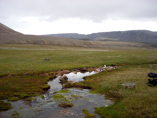 Looking back at our route, from the lowlands. We descended from the bench near the darker granite on the right of this image. We refilled our water bottles again at this stream, in which we saw a few small fish. Arctic Char (Salvelinus alpinus) are the only freshwater fish in the High Arctic; presumably the tiny fish we saw were juveniles.
 One of the many lakes of the Truelove lowlands, which we skirted around on our way back to camp.
I think the people in camp were a little surprised to see Eric and I back before dinner time. We dropped our packs, took off our boots, and generally just sat around for about half an hour after our arrival at about 5:15. The maps we have of the Truelove area suggest that Eric and I covered nearly 30 kilometres and 400 metres of altitude change today.
Tomorrow there is a possibility that I will fly back to Resolute with Steve, depending on the weather and the availability of aircraft. This mostly depends on the requirements of a research group working on the Belcher Glacier, who have two camps and need to shift some equipment and personnel around, and on how hard Steve lobbies to get out. My own desires to clean my laundry rank poorly in the list of motivators of flight schedules.
We made very good time, despite the moderately-heavy backpacks we were each carrying, and by about 8:45 we crossed out of Truelove’s polar oasis habitats and into the polar desert habitats of the greater part of Devon Island.
A satellite image from Google showing the Truelove lowlands (on the left, dark green) and the terrain adjacent to the East and South. The Truelove river is the black line meandering across the bottom of the image. The large light-coloured blob is the Dolomite Dome, which appears as two separate hills when viewed from ground level. The scale bar is 2 km long (1 mile marked below).I took this photo at about 8:30am. The spine of dark granite in the middle distance marks the edge of the Truelove lowlands. Behind it and to the right the Truelove river, the Southern border of the lowlands, flows towards Jones sound which separates Devon from Ellesmere.Among the granite boulders on the upper parts of the granite spine we encountered an Arctic Hare (Lepus arcticus). It seemed surprisingly unafraid of us, and Eric was able to approach to within about 5 metres to photograph it. It didn’t run away from us, even after our photography when we rather noisily continued on our way.Looking back towards the West, from just above the Truelove river. The terrain we were walking through at this point was very clearly the result of glacial and river erosion of the surrounding granite-and-dolomite rocks. There were no trails, but much of our walking was through what were obviously old riverbeds. I suspect this river has changed its flow rate drastically in the past, drying to a mere trickle at some times and expanding to a raging flood at others. Currently, the river flows swiftly, and appears to be about 2 metres deep in the center on average.We found a musk-ox (Ovibos moschatus) skull perched upon a rock. Somebody else has been here before us, but Arctic conditions mean I have no idea how long ago this animal died, or when the skull was moved. The rest of the skeleton was scattered over a few square metres, about 20 metres away.An Iceland Poppy (Papaver nudicaule), about 20 cm tall. Most of the glacial / river valley was just barren rock with a little encrusting lichen for colour. However, sheltered pockets contained agreeable microclimates, and sported some surprisingly healthy-looking plants, like this one here. We saw many poppies, some as large as this one, others much smaller and growing in more exposed areas.Another warm microclimate, this time adjacent to a tiny stream, about 10cm at widest. I took this picture because of the “stoplight” appearance of these mosses and lichens.I named this pond “Dolomite Pond”, because it is floored by light-coloured dolomite. I sampled here, on the far shore and at the outflow (to the right). There were some interesting worms (Enchytraeidae) and insect larvae (Chironomidae and Tipulidae) among the decaying moss around the rocks and mud. The surrounding meadow was also interesting, and included a number of plants that were uncommon or absent on the lowlands. Eric found Arctic Blueberries (Vaccinium uliginosum) just above the pond, which he had not found in Truelove but had seen on Ellesmere Island at Alexandra Fjord.Looking to the West, from above and East of Dolomite Pond. We stopped for lunch after climbing up a rough granite boulder-field above Dolomite Pond. We had intended to reach an apparently-smooth bench of dolomite above us, that looked like easier walking than the tumbled granite we were in. Once again, the Arctic fooled us, and it was much further and harder to get to the dolomite bench than either of us expected. As can be seen here, the terrain on the bench is not particularly smooth or flat, and there are many boulders scattered about. In addition, dolomite erodes to form razor-sharp, jagged edges, such that the bit of scrambling we periodically engaged in put us at risk of sliced skin on our fingers and hands.We walked along the dolomite bench for a bit, then decided we needed to set a turn-around point since it was becoming clear we were unlikely to actually reach the base of the glacier. At this point, we had just rounded the major Northward-turning bend of our path, and we could not see anything glacier-like (our search image for this task was basically anything enormous, distant, and icy). So we went up, intending to cut a diagonal path to the West and North over the top of the dolomite dome. The going was tough.It took about an hour for us to power our way up the steep side of the dolomite dome. Dolomite is rapidly becoming my least-favourite natural material, because of how it erodes and weathers. At smaller scales, I’ve already mentioned the razor-sharp edges on the boulders and rocks. At larger scales, dolomite appears to slump into a series of benches. Each bench appears to be the summit when viewed from below, until one stands upon the lip of the bench and sees the next rise immediately in front. I think we crossed 10 or 12 such bench-edges, to the point that I did not really believe it when we finally did achieve the summit.
Our reward on the top of the dolomite dome was a view of the Devon Ice Cap, the ice field that is the source of several glaciers, most notably (from our point of view) the Belcher Glacier that flows North. I really felt like I was looking back in time 100 000 years, to the ice of the Pleistocene, the “ice age”. Views like this must have been common throughout Northern North America, Europe, and Asia as recently as 15 000 years ago.This pyramidal boulder seems to represent the true summit of the dolomite dome. We didn’t actually ascend the final gentle slope to it, partly because we didn’t want to risk yet another disappointment generated by a bench of stone. The terrain here is mostly smallish pieces of dolomite, smashed and packed together into a solid mass.Eric and I were happily striding along over the easy terrain of the top of the dome when we nearly stumbled upon this ravine. We pondered for a minute or two, then decided to descend the ravine and follow it out to its mouth to the South, rather than trying to go around its upper end to the North or re-ascend a dolomite slope on the far side. Partly this decision was based on our uncertainty regarding the terrain ahead: a descent and climb would be tiring, and there could easily be another ravine hiding just over the near horizon. The walls of this ravine are steeper than this picture makes them look, they’re probably pitched at close to 35 degrees. The dolomite pieces of the walls of the ravine are distinctly geometric shapes - I stepped on numerous pieces that were straight-edged squares, long rectangles, or triangles.The floor of the ravine, more jumbled dolomite, but at least here, like the summit, it’s reasonably flat. A stream emerged from underground a little way down the ravine, and Eric and I were grateful for the chance to refill our water containers. I also found some insect larvae here, probably Simuliidae (blackfly) larvae. There’s almost nothing at all in the water or growing on the rocks, so I don’t know what those maggots are eating.This spectacular waterfall was partially visible from several places along our ascent this morning, but we were never in a position with a clear view of the entirety of it. A river flows from the ice cap above and to the south through black granite before pouring off the cliff edge in a fantastic spray. The sound of this waterfall was audible everywhere in the valley and on the dolomite. The patch of brownish-green to the left of the falls (not really visible in this picture, sorry) is a steep shelf of granite covered by what appears to be a thick layer of moss, supported by the continuous spray from the waterfall. The main fall strikes a large boulder or shelf (that we could not directly see) about 2/3 of the way down, creating a back-spray that soaks the mossy shelf. Basically, it’s always raining there in summer. I suspect that micro-ecosystem will perish when erosion inevitably changes the shape of that strike-plate, ending the permanent rain.Another view of the waterfall, with the Truelove river below.Yet another view of the waterfall, taken from where Eric and I rested for a few minutes and voraciously consumed beef jerky. We came out of the ravine well above our path this morning. We suspect the ravine terminates near the river in the form of a largish ditch that Eric and I briefly noted on our way across. The upper areas of the valley on the North side are covered in quite lush meadows that are generally very wet. There are few decent places to sit down, but we did OK.Our approach to the Truelove lowlands, higher and further North than our departure route. The dark line of granite in the middle distance on the left is the edge of the ridge we crossed this morning. Here, water seems to have pushed the edge of our bench down, disrupting the meadow in a sloping boulder pile. Nearly all of the lowlands are visible from the spot just ahead, with only the part closest to the dolomite dome on the right hidden from view.After admiring the view, and eating yet more beef jerky, we chose a careful path down through a boulder field of mixed granite and dolomite, with the sound of water trickling through concealed passages beneath us. By this point, we were both pretty tired and well knew it, so we went more slowly than had been usual up to this point, because a twisted ankle or sprained wrist at this point would be really, really annoying.
Looking back at our route, from the lowlands. We descended from the bench near the darker granite on the right of this image. We refilled our water bottles again at this stream, in which we saw a few small fish. Arctic Char (Salvelinus alpinus) are the only freshwater fish in the High Arctic; presumably the tiny fish we saw were juveniles.One of the many lakes of the Truelove lowlands, which we skirted around on our way back to camp.I think the people in camp were a little surprised to see Eric and I back before dinner time. We dropped our packs, took off our boots, and generally just sat around for about half an hour after our arrival at about 5:15. The maps we have of the Truelove area suggest that Eric and I covered nearly 30 kilometres and 400 metres of altitude change today.
Tomorrow there is a possibility that I will fly back to Resolute with Steve, depending on the weather and the availability of aircraft. This mostly depends on the requirements of a research group working on the Belcher Glacier, who have two camps and need to shift some equipment and personnel around, and on how hard Steve lobbies to get out. My own desires to clean my laundry rank poorly in the list of motivators of flight schedules.
Subscribe to:
Posts (Atom)

